
In this meeting we had guest speakers from Neighborhood Foresters talk about how catch, curb and correct trees before they’re labeled a hazard, and held a discussion on the St. Louis Strategic Land Use Plan.
Introduction
Meeting Called to order (Dan Doelling)
Public Comment (Dan Doelling)
- No public comments at this time.
FPSE Neighborhood Business
Ward 9 Updates (9th Ward Alderman Michael Browning)
- Contact Information
- Email: browningm@stlouis-mo.gov
- Phone: 314.622.3287
- Fax: 314.622.4273
- Address: City Hall, 1200 Market Street, Room 230, St. Louis, MO 63103
-
- Board of Aldermen has been on break for the past few weeks, so no updates on board bills.
- Upcoming events in the ward
-
-
- Public Workshop for the Strategic Land Use Plan (SLUP)
- Date: Tuesday, January 23, 2024
- Time: 5:00pm to 7:00pm
- Location: Mission: St. Louis, 3108 N Grand Blvd, St. Louis, MO 63107
- Northbound Kingshighway Lane Shift
- Dates: Starting February 14 and continuing for 6 weekends in a row
- Location: All northbound lanes of Kingshighway will be diverted into one lane on the southbound side.
- Recommendation: Avoid it if you can, as there will be a little more congestion.
- Background: New steam tanks for the new Barnes Jewish Hospital inpatient tower will be installed under Kingshighway
- Public Workshop for the Strategic Land Use Plan (SLUP)
-
- Citizens’ Service Bureau (CSB) Requests
-
- If you have anything that the city needs to fix (pothole, overflowing trash can, missing street sign, etc.), reporting it to CSB is the fastest way to get it fixed. They will route it to the proper department and help get it fixed.
- Ways to report
- Live Chat
- Report Online
- Report by Phone at 314.622.4800
- “Tweet” @stlcsb on “X” (formerly “Twitter”)
- Next month’s FPSENA Meeting
-
-
- Encourages everyone to attend next month’s meeting, as the community will have a chance to weigh in on some new development at a very exciting spot in the ward.
-
- Board of Aldermen Rams Settlement Public Engagement
-
- We have reached the final vote on priority challenges.
- Suggestions have been narrowed down to 20 “priority ideas” and you can go online to vote to tell the Board of Alderman which ideas the City should prioritize for deeper vetting and highlight during public hearings.
- Voting is open until February 2nd at stlouis.citizenlab.co
Crime & Safety Report (Officer Nicola Walker, Neighborhood Liason Officer)
- Contact Information
- Email: ncwalker@slmpd.org
- Phone: 314.444.0107
- Non-emergency phone number: 314.231.1212
-
- Crime is still relatively down in FPSE.
- The majority of crime occurs along the Manchester Ave area.
- SLMPD has been doing direct patrols in the neighborhood.
- Crime is still relatively down in FPSE.
- Recent shooting on Hunt (shots fired into dwelling)
-
-
- No updates, it is still being investigated and no comments have been provided from detectives.
- Additional comments/context from Alderman Michael Browning:
- The shootings that occurred on Hunt and Talmage in the last month were both related to AirBNBs/short-term rentals. Alderman Browning emphasizes that this is part of the reason the city is cracking down on short-term rentals. The BOA passed regulations and we should see enforcement in this coming year.
- A reminder to everybody – if you see somebody walking around openly displaying a weapon, that would warrant police response. This is no longer allowed in the city unless you have a conceal and carry firearm permit, which most of the time, people do not. We want to respond to that before it becomes an escalation and shots fired.
- Alderman Browning emphasizes that these incidents that happened in the neighborhood are not indicative of a larger crime problem, but more so related to two problematic properties. We are working through the nuisance property process to get those short-term rentals shut down. If the owners are not going to take care of them and make sure that they are not being turned into wild parties, then we do not want them operating in the neighborhood.
- We want everyone to feel safe in the neighborhood and know that we are taking this seriously and making sure to regulate this type of thing in the future, because we have seen this tragedy play out across St. Louis way too many times.
-
- General Advice – Be Mindful
-
- When warming up your car
- It is best to sit in your car while it’s warming, unless you have an automatic start.
- A lot of cars get stolen during the winter time while cars are warming up unattended with the key in the ignition.
- Even if you do have an automatic start, put your key fobs away. A stolen car can get pretty far before the car shuts off without the key near it.
- At the gas pump
- Sitting in your car
- We encourage you to not sit in your car too long (text, talk on phone), as this could make you a target for robbery.
- Parking
- Lock your car and do not leave anything valuable inside.
- If you have to leave valuables inside your car, we encourage you to get a lock box installed inside your car to store your valuables.
- Catalytic converters
- Catalytic converters are still being stolen. There are no particular cars being targeted, so be mindful.
- Burglar safety
- In the evening hours, light the dark areas around the exterior of your home.
- Use lights with motion sensors.
- If you can, put an alarm or camera on detached garages, so you will have some type of video or heads-up if someone breaks in.
- When warming up your car
- If you have any concerns or issues on your block or there is something that you want to make us aware of, please reach out.
- If Officer Walker is not in the office, an email is easier than a voicemail for her to follow up.
- If you have any upcoming events that you would like officers to stop by, let us know (the earlier, the better).
Treasurer’s Report (Evan Veremakis)
- November and December 2023
- Expenses: $31.98 (for Zoom)
- Revenue: $35.00 (dues and donations)
- Ending Cash: $1,820.21
- 2023 Year End Review
- Expenses
- $3,113.63 Total
- $189.88 for Zoom
- $287.76 for FPSENA Operation (website domain and hosting)
- $2,635.99 for FPSE Great Gathering Event
- $3,113.63 Total
- Revenue
- $2,690 (dues and donations)
- Ending Cash
- $1,820.21 ($388.63 less than January 2023)
- Expenses
- Membership Dues
- General Membership dues start over in new year.
- Dues are pay-what-you-can.
- Members get voting privileges.
- How to pay
- Cash App: $FPSENA
- Cash/Check: Send an email to forestparksoutheast@gmail.com to coordinate
Neighborhood Events (Dan Doelling)
- Tree Pruning: Each 1st Sunday of the month, 10am-12pm, from November – April
- Tools and certified arborist coordination provided by STL Neighborhood Foresters
- Upcoming Dates
- February 4 – Chouteau Park, meet @ southwest corner
- March 3 – Location TBD
- April 7 – Location TBD
- Stay updated on our website, Facebook, & email
- Previous Dates
- November 5 – Chouteau Ave & Taylor Ave, Gibson Ave & Taylor Ave
- December 3 – FPSE Dog Park @ Chouteau Park
- January 7 – Corner Garden at Gibson Ave and Tower Grove Ave
- Monthly Clean-up: Each 4th Saturday at 10am, from March – October
- Meet at Manchester Ave and Newstead Ave
- 2024 Dates
- March 23
- April 27
- May 25
- June 22
- July 27
- August 24
- September 28
- October 26
- Event Committee: Join!
- Help plan events, design flyers, coordinate events, draft sponsorship opportunities.
- To join and/or for more information, send an email to forestparksoutheast@gmail.com
Guest Speakers:
Neighborhood Foresters (Erin Godwin and Suzanne Leguey-Feilleux)
-
- Neighborhood Foresters’ mission is to increase the tree canopy in the City of St. Louis by creating resident-volunteer groups in every neighborhood to care for the young trees that have been planted in each neighborhood by the Forestry Department.
- (Some) Benefits of Urban Trees
- Increased shade
- Increased carbon sequestration
- Increased social interaction
- Increased property values
- Reduced heat island effect
- Increased habitat and biodiversity
- Reduced storm water run-off/flooding risk
- Increased human physical and mental wellbeing
- Conservation of energy (due to temperature control)
- Reduced noise and dust pollution
- Increased urban resilience
- Reduced erosion
- Better air quality
- There is a direct correlation between tree canopy coverage and surface temperature disparities (see video recording at 21:13 for St. Louis City heat map comparisons).
- Forest Park has 31-35% tree canopy coverage and Tower Grove Park has >35% tree canopy coverage and have -5-0° surface temperature disparity (more trees and cooler temperatures)
- Downtown, central corridor, and industrial areas along the riverfront have 0-10% tree canopy coverage and 10-20° surface temperature disparity (less trees and hotter temperatures)
- Forest Park Southeast Tree Canopy Coverage
- Relatively low
- Northwest FPSE: 16%
- Northeast FPSE: 5%
- South FPSE: 10%
- City Average: ±20%
- General Goal: >30%
- So there is room for improvement in FPSE’s tree canopy coverage
- (see video recording at 21:48 for map visual)
- Relatively low
- Ways to Maintain Existing Trees and Help Planting Efforts Succeed
- Watering Young Trees
-
-
- MetroTreeLC web application
- The goal is to connect trees that have been recently planted to people who can water them.
- Create an account and adopt a new neighborhood tree to care for
- Receive text/email reminders for watering
- So you will know if it has been dry enough that you need to water and how long it has been since you’ve watered
- Water your tree during dry periods
- We are also available to provide additional help:
- Figure out the best way for you to water
- How much to water (typically at least 5 gallons or more per week)
- The goal is to connect trees that have been recently planted to people who can water them.
- Each tree planted by the city represents a significant investment of time and resources, so allowing them to potentially die just because they don’t get enough extra water in the summer, during dry periods is an unfortunate outcome that we see a lot and it’s a big waste that we want to avoid.
- (see video recording at 24:08 for map of recently planted trees in FPSE)
- MetroTreeLC web application
-
- Help Plan New Tree Plantings
-
-
- Ideally we want a diverse variety of moslty native species.
- Non-native species can provide shade and beauty, but do not provide the same environmental and ecological benefit as food and habitats for native insects, birds, etc.
- Street Trees Inventory
- The City of St. Louis Forestry Division maintains an active database of trees that it manages. You can go online and use the GIS-based inventory for street trees and nearly all of the City’s larger parks as well as download the dataset.
- The dot colors on the map vary based on species.
- Looking at the map of FPSE, there might be some opportunity for future tree planting.
- It is better to be proactive and push for that investment rather than just hoping it happens.
- If there isn’t enough money in ward capital, there are other resources if there is interest in doing a planting (i.e. grants that could be applied for).
-
- See video recording at 26:44 for map of city maintained trees in FPSE.
- Help Maintain the City Tree Inventory
-
-
- You can get an account from the city website to be able to submit updates for the tree inventory.
- Some of areas, the city’s data is 20-50% out of date.
- Help us get a better idea of what trees are already planted and what opportunities can be seized upon. We can’t really plan well for the tree canopy and put those investments where they are most useful if we don’t have a good vision of what’s going on on the ground now.
-
- Pruning
-
- Learn how from a certified arborist at a neighborhood event.
- The city has a program where you can be approved to perform clearance pruning on street trees on your own.
- For more information on STL Neighborhood Foresters:
-
- Website: stltreelc.org (now stlnf.org)
- Sign up for their newsletter
- Email: infow@stlnf.org
- Facebook: STL Neighborhood Foresters
- Instagram: @stl_nf
- Website: stltreelc.org (now stlnf.org)
City of St. Louis Strategic Land Use Plan Workshop (Annemarie Spitz and Liz Kramer)
-
- Annemarie and Liz are part of the consulting team that is working with the City of St Louis’s Planning and Urban Design Agency on the Strategic Land Use Plan (SLUP) update process. They are both based in St. Louis, although members of their consulting team are based elsewhere in the United States.
- They have a series of past and future workshops that they do with groups and have translated the discussion part for tonight’s virtual workshop.
- What is The SLUP?
-
-
- Like “soup,” but with an “L.”
- It’s a key part of the city’s Comprehensive Plan.
- It basically establishes a vision for how we should best use the city’s land.
- It’s a guide for future development.
-
- Why is the SLUP important? Why should I care about it?
-
-
- It authorizes what kind of development can happen where.
- Redevelopment plans, zoning text amendments, rezonings: all these things are reviewed against the Strategic Land Use Plan to determine if it complies.
- The SLUP is setting a legal guideline for what the community’s aspirations are for future development.
-
- Why does the SLUP need an update?
-
- A lot has changed in St. Louis since the first Strategic Land Use Plan (SLUP) was created in 2005.
- It has been amended over 20 times since then for
- Redesignations of sites to reflect recent development
- New opportunities, or changes in ownership of institutional properties
- Adjustments to descriptions of use categories
- Alignment to adopted neighborhood plans
- Evaluation of sites designated as Opportunity Areas
- This is the first time that the document has really been reconsidered from a holistic perspective and it gives us a chance to think comprehensively across the whole city about the way that we think about land use and how it can reflect our current conditions and aspirations.
- It’s also important, because it is an opportunity for us to better reflect priorities. That might be things like economic justice, walkability, transit-oriented development, and climate resilience.
- You might think about 2005: we didn’t have much of a MetroLink system at that point in time. Things have really changed across the whole city and we have big plans for new greenways, new transit systems, and we know a lot more about what the future might look like in climate and we want to make sure that those things are reflected in this upcoming plan .
- Questions include:
- Are the current land use designations right?
-
-
-
- There are 10 current designations in the Strategic Land Use Plan:
- Business/Industrial Development Area (BIDA)
- Business/Industrial Preservation Area (BIPA)
- Institutional Preservation and Development Area (IPDA)
- Neighborhood Commercial Area (NCA)
- Neighborhood Development Area (NDA)
- Neighborhood Preservation Area (NPA)
- Opportunity Area (OA)
- Regional Commercial Area (RCA)
- Recreation/Open Space Preservation and Development Area (ROSPDA)
- Specialty Mixed Use Area (SMUA)
- You may have heard of them before you may not have. Some have obscure titles that go along with them and they’re frequently identified using acronym shorthand.
- We’re exploring if these designations still make sense and how we might talk about them. Some of that has included the team reviewing other cities’ land use plans and thinking about the language that they use and the kind of specificity that they offer.
- There are 10 current designations in the Strategic Land Use Plan:
-
-
- See video recording at 35:55 for an A through O list of some of the types of land use designations other cities are using.
-
-
-
- They look pretty different than the ones that we use right now, so that’s something that that we’re thinking through.
-
-
- Are the designations specific enough?
-
-
- The current SLUP is 26 pages long and when you look at the specific pages about the designations, there’s not a lot of text describing what they are.
- So there is an opportunity to say what it take for these to be specific, so that neighbors and residents can really understand them and they can help guide what kind of development we’re asking for in different places.
-
- Is it a user-friendly document?
-
-
- At the moment, it might not feel approachable to everyone who’s using it.
- We want to make sure that it can be a tool that’s user friendly across St. Louis.
-
- Does it have buy-in?
-
- We’ve asked lots of people if they have ever heard of this document and there’s a very small number who know that it exists.
- We want to make sure that it’s something that is known across St. Louis and is really serving the purpose it should.
- How does the Strategic Land Use Plan relate to neighborhood plans?
-
-
- This is a Citywide plan, so it’s providing a comprehensive vision of land use across St. Louis and neighborhood plans are really meant to layer on top of that.
- That isn’t to say that neighborhood plans wouldn’t influence the Strategic Land Use Plan, because at no point should that plan be promoting things that are out of alignment with what a neighborhood plan is saying should happen.
- So you might think about the Strategic Land Use Plan as the broad brush strokes addressing things that are comprehensive across the whole city, which might include things like transit or heat, while the neighborhood plans can get into much more fine-point detail thinking about what’s happening within a specific neighborhood and even how some of those things come to fruition
-
- Will the SLUP actually be implemented?
-
- The SLUP expresses an aspiration for what should be built in specific locations in the future through development processes. It is not a play for development, and does not guarantee that something will actually happen at identified locations.
- Rather, when someone decides they want to invest money into a site, whether the investor is the City, a private developer, or someone else, the SLUP guides what can be put in a particular place. The SLUP comes into play to say, “OK, what is it that we aspire will happen here?”
- Project Schedule
-
-
- To give you a little bit of a sense of where we are right now, we’re still pretty early in public engagement, but we’re at the point where we’ve done a fair amount of assessment of the current Strategic Land Use Plan, what’s happening on the ground, and we’re moving into a phase of understanding what are the visions and goals for St. Louis and getting into some of those detailed updates to the plan.
- The goal is for this plan to be adopted by the end of 2024. The plan is adopted by the Planning Commission, so that is the group that will review and adopt it.
- We have a newsletter that actually just arrived hot off the presses today. So we’re going to be distributing that, but we’ll have a series of these newsletters that come out to help get people plugged into the idea of what this is and what it might look like.
- For more information, you can visit the SLUP website, www.slup-stl.com, where you can find more information, including a version of this slideshow presentation if you want to look back at it later.
-
- Series of public workshops:
-
-
-
- Both in-person workshops and virtual workshops.
- We’re going to be spending a lot more time in-depth dealing with some of the tensions that have come up from what we’ve heard from the public so far. So really grappling with how do we deal with things like:
- The fact that people want to live in walkable areas and we rely on cars to get around in our region.
- How do we think about having active and vibrant commercial spaces, while we know that our population is spreading out across the region?
- What can we do to make spaces feel really active?
- Tonight’s discussion will be a little taste of those workshops.
-
-
- Next public workshop:
-
-
-
-
- Tuesday, January 23rd, 2024, 5:00pm to 7:00pm (CT) @ Mission: St. Louis (3108 N Grand Blvd, 63107)
-
-
-
- Audience Questions:
-
-
- Q: When you say neighborhood plans, does that include zoning overlays? Forest Park Southeast has a form-based code, which I’ve been told is a zoning overlay and is not a neighborhood plan. How would that play into this?
- A: (Full disclosure, Liz is not an urban planner, the following is her understand and she will get back with 100% confirmation, through Dan Doelling). Liz’s understanding is that the Form-Based Code that exists in Forest Park Southeast is not an adopted neighborhood plan. The Strategic Land Use Plan is also not about zoning. Zoning is a regulatory tool that will be updated following the Strategic Land Use Plan’s update. So the Strategic Land Use Plan will not affect your zoning overlay right now, because this is about land use as a big tool, as opposed to zoning as a sort of more specific and more targeted tool.
- Q: Does this mean that the city is officially leaving the Team Four Plan? Are they admitting that they’re no longer going to use that? And will this allow people to use their property with more freedom?
- A: The Team Four Plan that you’re referring to was an attempt in the 1970s to update the comprehensive plan for the City of St. Louis. The Team Four Plan was never formally adopted by the city and is not what’s currently in use today. The 2005 Strategic Land Use Plan is the one that we’re updating. That is the comprehensive plan that is currently used by the city. So the goal, and I think I am interpreting that in your comment, one of your questions might be, “Is this like the Team Four Plan?” And we are hoping that this is a much more community-driven process, where we have input from across St. Louis, and perspectives that really reflect what it is that the community wants. I think, again to get back to that idea of buy-in, that folks really have buy-in into this idea in a way that plan did not.
- A: That’s certainly, I would say, a core issue that we’re hearing from neighbors who’ve been in St. Louis a long time that have real distrust in planning and how it’s happened in the past. So we are not saying that that is not true, we’re saying that we haven’t been a part of that and what we’re part of now is trying to make sure we do it in a different way so that there is involvement and people do feel confident in how the plan is moving forward in this new version. Because absolutely we want it to be very different than both the perception and reality of what happened with the the previous plans. You know we’ve heard about multiple kinds of areas of broken trust in the past. So thank you for raising that, because that’s certainly something we’ve heard from others as well. We want to make sure that we are taking steps to make sure this is does not feel like that as we continue to move forward with this engagement.
- Q: When you say neighborhood plans, does that include zoning overlays? Forest Park Southeast has a form-based code, which I’ve been told is a zoning overlay and is not a neighborhood plan. How would that play into this?
-
- Interactive Discussion:
-
-
- In addition to the in-person workshop next week, there will be several virtual workshops that are a bit later, and we’ll have some interactive activities at those as well toward the end of the month. We want to just give you a taste of some of the discussion prompts that we’ll use in those more interactive sessions, but today we’ll just do them verbally so that you can both share your input now if you’d like or can get a sense for if you’d like to participate in one of those upcoming sessions.
- Prompt: What makes a place active and vibrant?
- One area that we’ve heard is that people are really interested in having active and vibrant commercial areas as part of both in their neighborhoods and places that they can go around the city.
- As we think about those places in our communities that have businesses, restaurants, bars, how do we want those to be to be a supportive part of our neighborhood and to feel vibrant?
- Think about an area in your neighborhood where there are businesses, restaurants, etc., and ask you to think about what makes that area feel like a vibrant part of your neighborhood.
- That might be something that has been there for a long time, or maybe something that is newer, something that has changed over the last 5 or 10 years. We know that many parts of your neighborhood have changed over time. We’re curious to hear about how those changes also impact vibrancy.
- Is there a particular place in the neigh
-
- Responses:
-
-
-
-
- Walkability
- Close neighborhood community
- Curbside/outdoor dining
- Examples: Rise, Songbird, Chroma
- Slower traffic
- Being able to cross the street and walk around
- Festivals
- Vibrancy runs two ways – it’s a service that businesses might offer to the community to provide space of vibrancy, but then there also needs to be support for those businesses to be able to stay. And we’ve certainly heard that from others. Kind of the reality or perceptions of challenges around small businesses, in particular, being able to stay.
- How can we better support neighborhood businesses to stay?
- Active storefronts, where you can see the retail/restaurant activity inside (example: Tower Grove and Manchester)
- People out and about
- People being able to walk, run, and bike
- Pets walking their people around
- Tree canopy
-
- Prompt: When you think about how your neighborhood has changed over the last five or ten years, or maybe even those who have been there longer, is there a change in what you would perceive as the sense of vibrancy and what’s been causing those changes? Areas that are more or less vibrant than they used to be?
- What changes to either the buildings or the lots in your neighborhood would you want there to be in order for it to feel more vibrant and more active? What kinds of things would you want to see in either the, you know thinking primarily about the commercial areas or the streets around those, what changes would you hope for.
-
-
- Responses:
-
-
-
-
- Missing/fewer:
- some businesses that have closed recently (Rise, Ready Room, Atomic Cowboy)
- Live music venues / hearing music while walking around the neighborhood
- Less of that interaction you get with people
- Less of that the ambiance that you get from living in a city
- Places for people to go at different hours of the day
- Somewhere to go in the morning hours
- Murals
- Add to the visual stimulation when walking around the neighborhood
- Want to change:
- Increase foot traffic
- Missing/fewer:
-
- Prompt: From your perspectives, what about land use makes an area nice to walk or bike or take transit around?
- One thing that we’ve heard is that one aspect of quality of life is being able to have a nice experience walking or biking or taking transit in our communities.
- Think about if there’s a part of your neighborhood that stands out to you, or maybe other places you go as well, where you’d like to have a little bit of a better experience walking or biking or taking transit.
- Maybe it’s fine now, but how could it be better?
- We’re really wanting to understand from people in different neighborhoods is where are those places where you’re noticing that disconnect, because you all notice that every day. You’re thinking, like, oh I wish I could go over there it’s only five minutes away, but there’s not really a way that I feel comfortable getting there other than maybe driving there.
-
-
- Responses:
-
-
-
- More tree canopy
- Smoother areas for rollerblading
- Less wide streets, so it’s more comfortable for pedestrians
- Street level connections to buildings
- Not just seeing blank walls (ex: UCBC masonry wall along Manchester).
- Street level windows / entrances
- Connection not just within the neighborhood, but also how do you move outside of it comfortably as a walker or a biker or a transit rider.
- FPSE is separated from other neighborhoods by I-64, Kingshighway, Vandeventer, and the railroad
- Separated from Bar K and the apartment building(s) in that area
- No connection or sidewalk, other than along Vandeventer or Kingshighway
- Would be great to have a pedestrian bridge over the railroad
-
-
Final Remarks/Reminders (Dan Doelling)
-
- Other upcoming events:
- Infrastructure Committee Meeting
-
-
-
- Date: Wednesday, January 31st, 2024
- Time: 6:00pm
- Location: Park Central, 4512 Manchester Avenue
-
-
- February FPSENA Meeting
-
-
- Date: Tuesday, February 20th, 2024
- Time: 6:45pm to 8:00pm
- Location: Missouri Foundation for Health (4254 Vista Ave) and Zoom
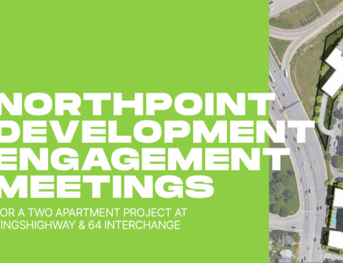
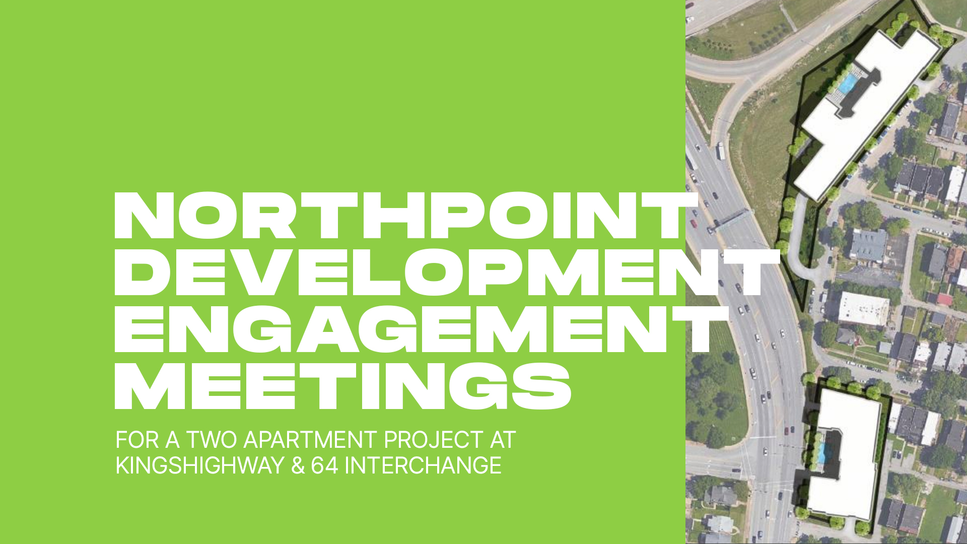
- Guest Speakers: NorthPoint Development Project Team
- A chance for the community to hear about plans for the Kingshighway site and share thoughts and feedback
-
You can download a copy of this meeting’s minutes below.
You can also listen to January’s meeting below, and wherever you get your podcasts.
